Thermal Clock

_dsc1859

We rely heavily on our vision to identify change. We see sand accumulating at the bottom of the hourglass. We see the minute hand rotate clockwise. How would our sense of time change if we cast time to another sense?

Thermal Clock is a timepiece that positions heat along a bar over a 24 hour cycle to tell time.

Using an array of peltier junctions, heat is emitted from a focused area moving from left to right along the bar over the course of a day.

_dsc1864

_dsc1857

Thermal Clock from che-wei wang on Vimeo.

Thermochromic Slow Resolution Display

A slow resolution display made out of standard lightbulbs and thermochromic paint.

This display lives at the intersection of digital control and analog output. A matrix of lightbulbs painted with thermochromic paint allows for an image to appear and dissipate analogously to the temperature of each bulb.

The overall effect defies our ordinary understanding of materials and time within technological systems.
In this case, lightbulbs are used for heat and not light. And the refresh rate of an image is constrained to the time it takes for the material of the screen to change temperature.

More on thermochromism here.

Here, we’re using 40 watt bulbs. They take a few seconds to warm up and turn white and a couple minutes to cool down and fade back to black.

Built by Alex Abreu, Taylor Levy, and Che-Wei Wang

Thanks to the dozens and dozens of you who helped make this project possible!


Thermochromic Display from che-wei wang on Vimeo.

dsc01550dsc01549dsc01546

dsc01540dsc01544dsc01536

Dreyfuss Bluetooth Handset

img_1145img_1152

This is a one-off hack to retrofit a genuine Western Electric Dreyfuss Telephone Handset into a full fledged Bluetooth handset. A single button at the center of the mouthpiece controls all the functions (pairing, answering calls, etc.), while a blue and red LED indicator glows from within. The handset recharges via USB and lasts 6 hours in active talk-time and 110 hours in standby mode.

Feedback Playback 2

dhpicture-9dhpicture-7

fb-1-352009fb-2-352009fb-3-352009

FeedBack PlayBack is a dynamic film re-editing and viewing system. The users’ physical state determines the visceral quality of scenes displayed; immediate reactions to the scenes feed back to generate a cinematic crescendo or a lull. We use material that is rigorously narrative, formulaic, and plentiful: the action movie series Die Hard, starring Bruce Willis. A narrative sequence key breaks any given Die Hard movie into narrative elements, corresponding clips were collected from each of the Die Hard movies. Individual clips fall into high, medium, and low action/arousal categories. The user is seated, and places his or her hands on a Galvanic Skin Response (GSR) detection panel (GSR readings are the same kind of data collected in lie detector test). After calibration, the movie begins showing, and clips are displayed depending on the user’s level of arousal and engagement. The narrative sequence is maintained, though the clips are pulled from any of the movies.

Tetherlight

Tetherlight is a hand held light that perpetually points at its sibling. Two Tetherlights constantly point at each other, guiding one Tetherlight to the other with a beam of light.


Tetherlight: Prototype 02 Rotation from che-wei wang on Vimeo.

The devices are each equipped with a GPS module, a digital compass, and a wireless communication module to locate, orient, and communicate its position to the other. They each calculate the proper alignment of a robotic neck to point a light in the other’s direction. In order to maintain the light’s orientation, an accelerometer compensates for the device’s tilt.

Tetherlights are for loving spouses, cheating spouses, girlfriends, boyfriends, children, pets, bags of money, packages, and pretty much anything that you would want to locate at a glance. An ideal use of Tetherlights would be in a situation where two people or two groups of people need to wander, but also need to locate one another in an instant. In a hiking scenario, a large group might spit up to accommodate different paces. With Tetherlights, understanding one’s whereabouts in relation to the other group is represented spatially with a bright light in the appropriate direction.

Tetherlight attempts to make one’s relation to a distant person more immediate by making a physical pointer instead of an abstract maps. With traditional maps, people need to communicate their positions, orient their maps, locate a point on the map, then look up in that direction. Tetherlight does it in an instant. The difference is like looking at a map to see where your uncle lives or having a string that’s always attached to him.

If you’re interested, here’s the Arduino Code: Tetherlight06xbeeGPS.pde

Feedback Playback

FeedBack PlayBack is an interactive, dynamic film re-editing/viewing system that explores the link between media consumption and physiological arousal.

This project uses galvanic skin response and pulse rate to create a dynamic film re-editing and veiwing system. The users’ physical state determines the rhythm and length of the cuts and the visceral quality of scenes displayed; the user’s immediate reactions to the scenes delivered, feeds back to generate a cinematic crescendo or a lull. This project exploits the power of media to manipulate and alter our state of being at the most basic, primal level, and attempts to synchronize the media and viewer– whether towards a static loop or a explosive climax.

In a darkened, enclosed space, the user approaches a screen and his or her rests fingertips on a pad to the right of the screen. The system establishes baseline for this users physiological response, and re-calibrates. Short, non-sequential clips of a familiar, emotionally charged film– for example, Stanley Kubrick’s 1980 horror masterpiece “The Shining” –are shown. If the user responds to slight shifts in the emotional tone of the media, the system amplifies that response and displays clips that are more violent and arousing, or calmer and more neutral. The film is re-edited, the narrative reformulated according to this user’s response to it.

Feedbak Playback is by Zannah Marsh and Che-Wei Wang

GSR Reader

Galvanic skin response readings are simply the measurement of electrical resistance through the body. Two leads are attached to two fingertips. One lead sends current while the other measures the difference. This setup measures GSR every 50 milliseconds. Each reading is graphed, while peaks are highlighted and an average is calculated to smooth out the values. A baseline reading is taken for 10 seconds if the readings go flat (fingers removed from leads).

Drum Space

Drum space is a percussion instrument that transforms environments into drums. Participants are immersed within the space of drums as beats are created from the surrounding surfaces. The audio experience of the space is negotiated by each participant as they add and remove beats from sequences previously constructed by other participants. Will the space be raging noise or subtle clicks?

Ornos: Prototype 02

dsc00490.jpg

Here’s the first test with Ornos. The compass readings are behaving pretty well considering it’s right underneath a spinning hard drive. The 1.2Ghz processor and 512 RAM don’t seem to be enough to download and render the image quickly enough, so I’m going to have to figure out how to speed things up.

Etek EB-85A GPS Example Code

etekgps5hz-02-m.jpg

Here’s some example Arduino code for getting a Etek EB-85A module up and reading latitude and longitude (will probably work with most GPS modules). You can purchase a module from Sparkfun.

The module only needs power, ground, rx and tx. Most modules like the Etek start sending NMEA strings as soon as it has power. The Etek module takes a minute or two to get a satellite fix from a cold start in urban environments. Signals drop out once in a while between tall buildings at street level even with DGPS and SBAS. On a clear day, if you’re lucky, you can get a signal sitting by the window in urban canyons.

//Etek GPS EB-85A Module Example
//by Che-Wei Wang and Kristin O'Friel
//32 Channel etek GPS unit
//modified from original code by Igor González Martín. http://www.arduino.cc/playground/Tutorials/GPS
boolean startingUp=true;
boolean gpsConnected=false;
boolean satelliteLock=false;

long myLatitude,myLongitude;

//GPS
#include 
#include 
int rxPin = 0;                    // RX PIN 
int txPin = 1;                    // TX TX
int byteGPS=-1;
char linea[300] = "";
char comandoGPR[7] = "$GPRMC";
int cont=0;
int bien=0;
int conta=0;
int indices[13];

//////////////////////////////////////////////////////////////////////////////////////////////////////////////////////////////////
//////////////////////////////////////////////////////////////////////////////////////////////////////////////////////////////////

void setup() {
  //GPS
  pinMode(rxPin, INPUT);
  pinMode(txPin, OUTPUT);

  for (int i=0;i

Ornos : Prototype 01

dsc00367.jpgdsc00371.jpgdsc00373.jpgdsc00490.jpg

I was going to cover the lasercut masonite with a leather sleeve, but I’m going to go with cnc milled RenShape with a painted finish for the next prototype. The compass needs to be calibrated to the offsets caused by the magnetized computer hardware and I need to tweak some code to get the frames to load faster and smoother. I’ll post a video as soon as that part is worked out.

Ornos : A View from Above

picture-4.pngpicture-3.pngpicture-2.png

Since the first hand drawn maps of the stars to satellite imagery and GPS navigation today, our frame of reference and our perception of space has been molded into a view from above. Our understanding of place is often linked to an abstract representation on a map rather than a physical relational comprehension. You could probably point out Azerbaijan on a map, but how many of us can simply point in its direction across the globe? The image of the globe projected onto a vertical surface is so pervasive, we often associate “up” with north as we project ourselves into a mental image of map.

The accessibility of GPS and online map services have continued to reinforce the “up” vector while creating a greater divide between the physical world and its virtual representations. Today, we view from above, as primarily experienced on our screens, in an elevation view without any regard to its physical context. We project our presence into the screen through multiple translations of orientation. Viewing a map on a computer screen requires one to find a location on the screen that represents a position, then the abstracted orientation of the vertical screen must be translated and scaled into the physical context of the current position. We’ve lost a step in comprehension without the compass and the horizontal map. The traditional map and compass gave an intuitive understanding of a current position in relation to physical space by rotating the map to align with the space it represented. What appeared one inch to the left of my location on the map could be confirmed by looking up to my left.

Ornos is a telescopic view from above. The horizontal screen reconstructs a view from a position directly above itself using satellite imagery and maps. Exploring your current surroundings is as simple as sliding the device on any surface to pan across the globe. Zooming is controlled by rotating the device itself. The onboard digital compass and GPS modules orient the image on the screen to reflect your physical surroundings while satellite imagery and maps are dynamically loaded from Google, Microsoft, or Yahoo.


Ornos : Prototype 01 from che-wei wang on Vimeo.

Here’s the first test with Ornos. The compass readings are behaving pretty well considering it’s right underneath a spinning hard drive. The 1.2Ghz processor and 512 RAM don’t seem to be enough to download and render the image quickly enough, so I’m going to have to figure out how to speed things up.

Laser Tether : Sketch

laser-tether-sketch1.png

Here’s a sketch of how the parts might fit to get the laser to freely point in any direction. 4 servo motors work in tandem to tilt the laser head. Batteries and the circuitry is stored in the bottom half of the cylinder. I was going to have a mechanical gyro to have it orient itself to the ground, but the form seemed too restricted, so I’m opting for a gyro sensor to deal with orienting the device to gravity.

Laser Tether

laser_caution.gif

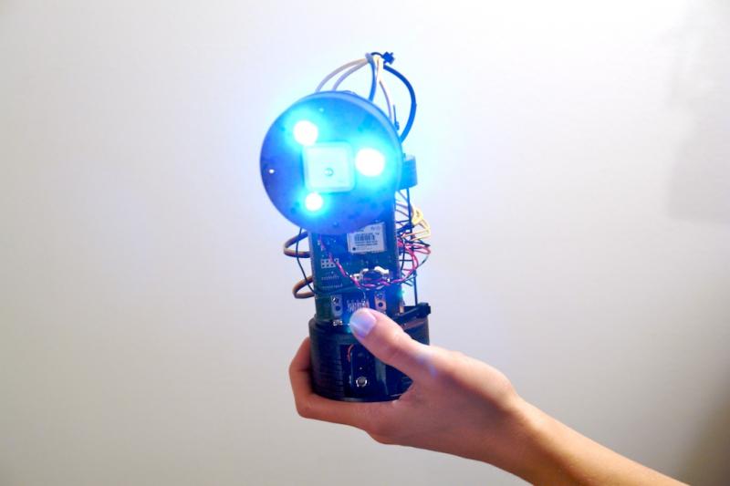
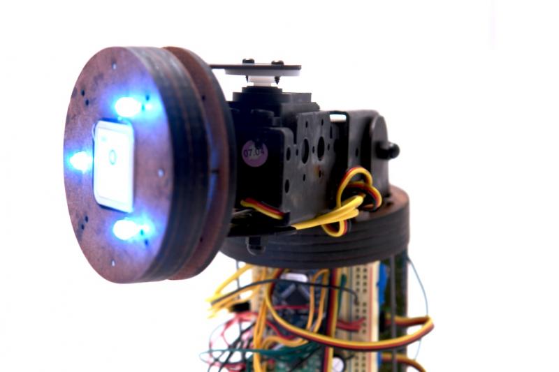
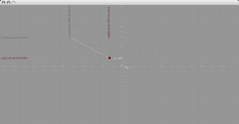
The Laser Tether is a hand held laser pointer that perpetually points at its sibling. Two Laser Tethers constantly point at each other no matter where they are on the globe. If my cousin in Beijing had a Laser Tether and I turned on mine in New York City, our lasers would point towards our feet as the lasers draw a straight line through Earth between my cousin and myself.

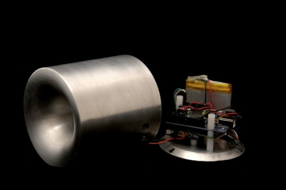
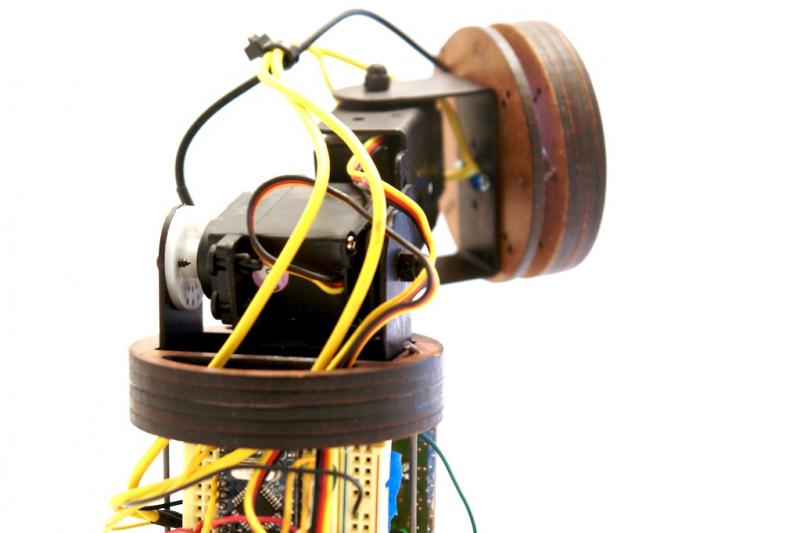
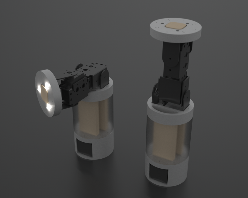
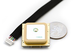
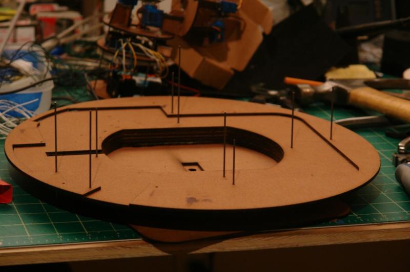
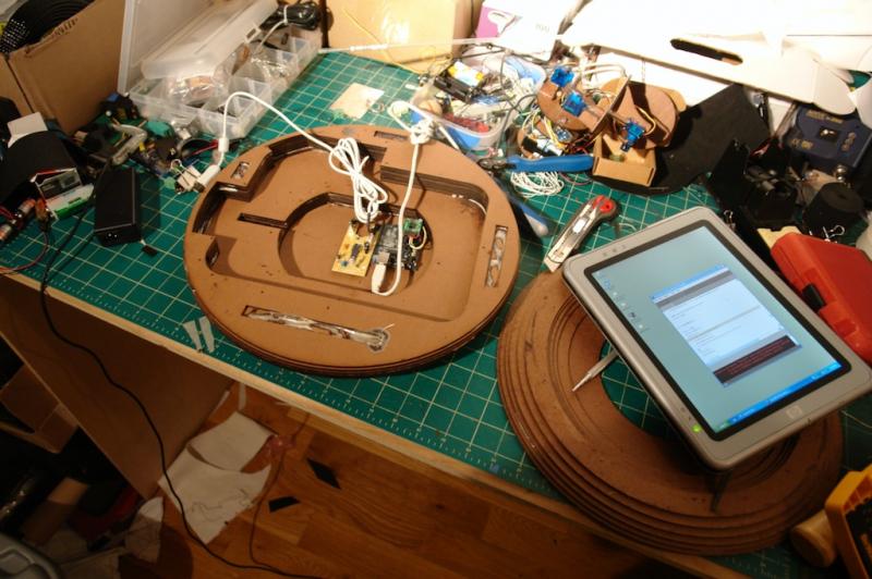
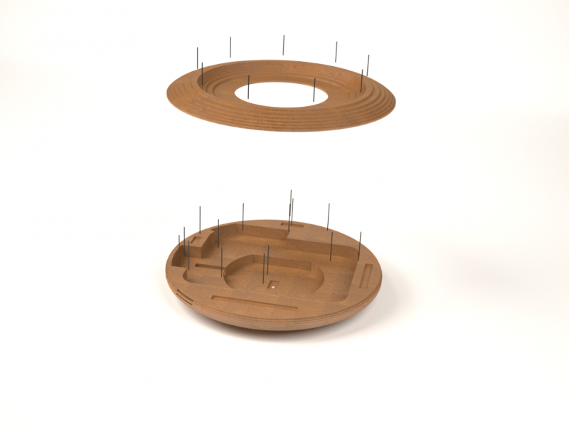
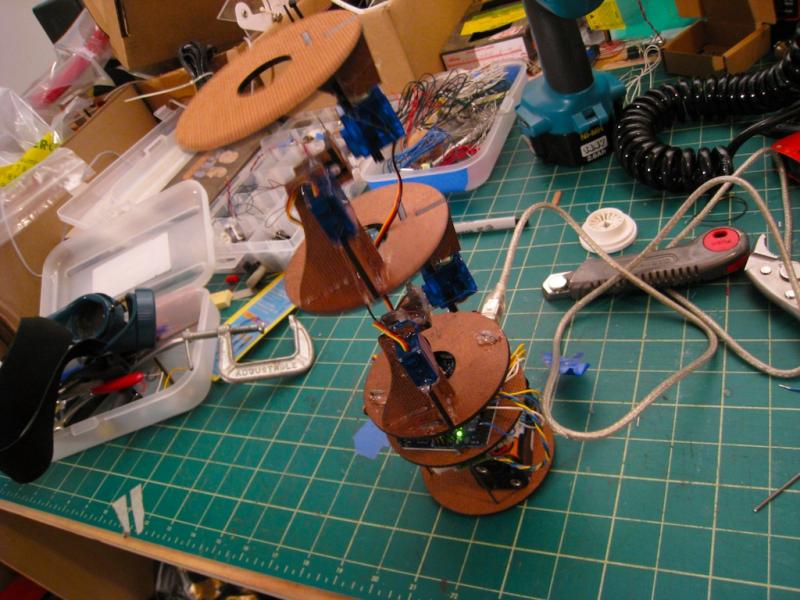
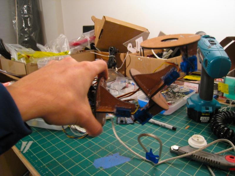
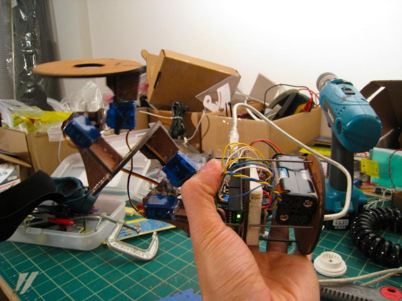
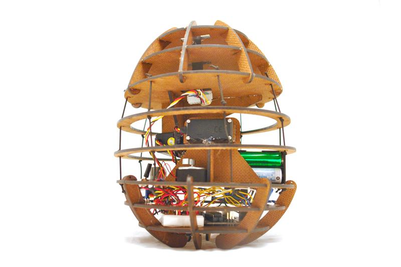
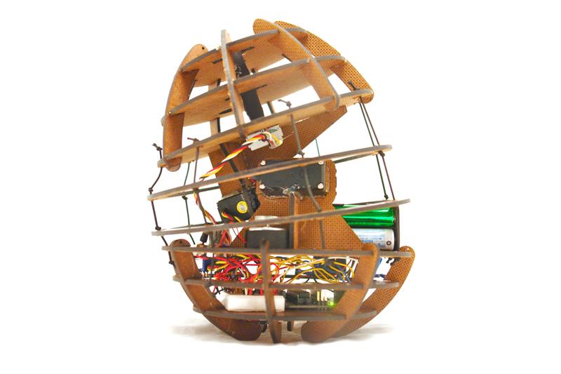
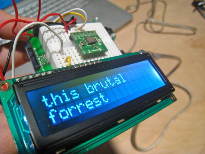
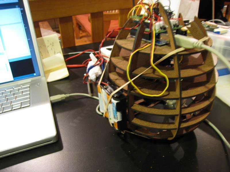
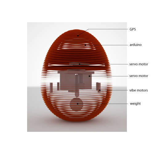
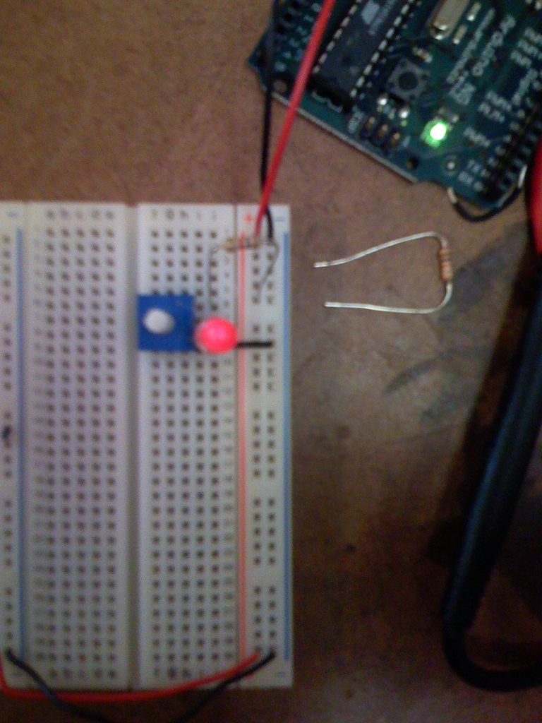
The devices are each equipped with a GPS module, a digital compass, and a cell network module to locate, orient, and upload its location to an online database. They then calculate the proper alignment of their lasers in relation to the other. In order to maintain an orientation that is always perpendicular to the ground, the lasers are mounted on a self leveling mechanism similar to existing laser levels like the DEWALT DW077KI.

Possible uses for the devices are for loving spouses, cheating spouses, girlfriends, boyfriends, children, pets, bags of money, packages, and pretty much anything that you would want to locate at a glance. Although potential uses are many, the scenarios I have in mind are for hiking, sailing, driving, caravaning, patrolling, playing tag, jogging, getting lost in crowds, hunting, tracking, spying, and battle strategy coordination. An ideal usage of the Laser Tether would be in a situation where two people need to wander, but also need to locate one another in an instant.

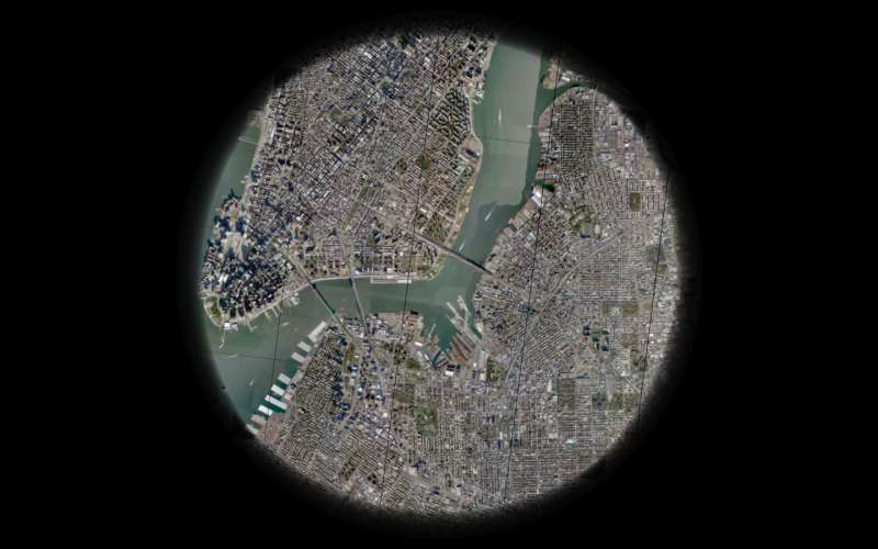
With GPS units becoming more pervasive, many GPS tracking applications have databases of people’s known locations. The emerging debate on privacy and accuracy are a major concern ((Katina Michael, Andrew McNamee, MG Michael, “The Emerging Ethics of Humancentric GPS Tracking and Monitoring,” icmb, p. 34, International Conference on Mobile Business (ICMB’06), 2006)), while the abstract representation GPS data in maps fail to convey a strong sense of immediacy and relevance. These applications like Navizon and Mologogo are open to large online communities and are visualized on maps. Common commercial applications of GPS tracking devices are used for fleet control of taxis and trucks, animal control, race tracking, and visualization. ((GPS tracking. (2008, January 27). In Wikipedia, The Free Encyclopedia. Retrieved 04:39, January 30, 2008, from http://en.wikipedia.org/w/index.php?title=GPS_tracking&oldid=187351992))

The Laser Tether attempts to make one’s relation to a distant person more immediate. The difference is like looking at a map to see where your uncle lives versus having a string attached to him.

moMo : Version 4

momo-version-4.jpgdsc00197a.jpg

momo version 4 now has a sturdier lighter frame. A couple switches were added to control power to arduino and to the GPS unit. The whole unit somehow runs off 4 AA batteries instead of 8. I also realized the compass unit is not as accurate as we’d like. It has a sour spot around 180-270 degrees where the measurements are noticably off by several degrees, not due to electromagnetic interference from the nearby motors.

moMo : A Haptic Navigational Device

dsc09935.jpgdsc09943.jpg

img_0497.jpgimg_0509.jpg

dsc00078.jpgdsc00076.jpg

Momo is a haptic navigational device that requires only the sense of touch to guide a user. No maps, no text, no arrows, no lights. It sits on the palm of one’s hand and leans, vibrates and gravitates towards a preset location. Akin to someone pointing you in the right direction, there is no need to find your map, you simply follow as the device gravitates to your destination.

momo-version-4.jpgdsc00197a.jpg

momo version 4 now has a sturdier lighter frame. A couple switches were added to control power to arduino and to the GPS unit. The whole unit somehow runs off 4 AA batteries instead of 8. I also realized the compass unit is not as accurate as we’d like. It has a sour spot around 180-270 degrees where the measurements are noticably off by several degrees, due to electromagnetic interference from the nearby motors.


momo version 4 (pov) from che-wei wang on Vimeo.


momo beta scenario 01 from che-wei wang on Vimeo.


moMo V2 : compass motion 01 from che-wei wang on Vimeo.

Precedents:
http://www.beatrizdacosta.net/stillopen/gpstut.php
http://www.mologogo.com/
http://mobiquitous.com/active-belt-e.html
http://news.bbc.co.uk/2/hi/technology/6905286.stm
http://www.freymartin.de/en/projects/cabboots

moMo : version 2

img_0439.jpg

-new compass unit calcuates true north in relation to itself and waypoint (so it points in the right direction even if you spin it)
-upgraded to 32 Channel!! ETek GPS module
-4 AA batteries powers the entire circuit with 5.6V at 2700mha
-a new skeleton ( to be outfitted with a flexible skin soon )
-updated code for smoother motion, although it’s soon to become obsolete as we move into a more gestural configuration ( like Keepon ) without the deadly lead weight.

HND: Shell

For moMo’s prototype shell, we’re initially cutting out cardboard sections into the egg shape. Our next iteration will be lasercut acrylic. Servo motors are counter balanced and secured throught the cutouts in the material. The GPS unit is housed at the top of the egg shape.

momo-0-r02.jpgmomo-0-r03a.jpg

cutouts-cardboard-02.jpg

A Haptic Navigational Device

A haptic navigational device requires only the sense of touch to guide a user. No maps, no text, no arrows, no lights. HND sits on the palm of one’s hand and leans, vibrates and gravitates towards a preset location. Imagine an egg sitting on the palm of your hand, obeying its own gravitational force at a distant location. The egg magically tugs and pulls you. No need to look at any maps. Simply follow the tug.

This is what we want to make. (Eduardo Lytton, Kristin O’Friel + me)

The possible user scenarios that can come out of this device range from treasure hunts to assistive technology for the blind.

Possible methods of creating the sensation of pull or tug:
Weight shifiting via servo motors
Vibrations motors
Gyroscopes | Gyroscopes.org

Precedents:
http://www.beatrizdacosta.net/stillopen/gpstut.php
http://www.mologogo.com/
http://mobiquitous.com/active-belt-e.html
http://news.bbc.co.uk/2/hi/technology/6905286.stm
http://www.freymartin.de/en/projects/cabboots

Observation: Crosswalk Button

At certain intersections, the city offers a push button at the pedestrian crosswalk with a sign that reads, “To cross street, push botton, wait for signal, wait for walk signal.”

Hypothesis: People love to push buttons. It give us a sense of control. So, people push the crosswalk button. And perhaps they push it several times to make sure it’s been pressed. They’ll keep checking for the green light to get a confirmation that the button had caused a series of events that will lead to a signal change in the very near future. People may also have slow responses to the changed green signal.

dsc09995.jpgSite:Location: 2 crosswalks 50′ apart, each with an island along the mediation strip between 6 lanes of vehicular traffic at Christopher and West St. Approximately 50 paces to cross.  1:30pm, 9/17/2007

Scenario #01:
Single male approaches red light. 25 years old.
25 seconds into waiting, stares at incoming traffic
44 seconds into waiting, stares across street, perhaps at traffic signal
58 seconds into waiting, light turns green. Begins walking immediately. (52 paces to the other side of the street)

Voltage Current Resistance

It seems like the prefered analogy for voltage, current and resistance uses water with pressured tanks, hoses, etc. The waterfall analogy was the easiest for me to understand.

If we draw an analogy to a waterfall, the voltage would represent the height of the waterfall: the higher it is, the more potential energy the water has by virtue of its distance from the bottom of the falls, and the more energy it will possess as it hits the bottom. . . If we think about our waterfall example, the current would represent how much water was going over the edge of the falls each second. . . In the waterfall analogy, resistance would refer to any obstacles that slowed down the flow of water over the edge of the falls. Perhaps there are many rocks in the river before the edge, to slow the water down. Or maybe a dam is being used to hold back most of the water and let only a small amount of it through. . . if you think about our waterfall example: the higher the waterfall, the more water will want to rush through, but it can only do so to the extent that it is able to as a result of any opposing forces. If you tried to fit Niagara Falls through a garden hose, you’d only get so much water every second, no matter how high the falls, and no matter how much water was waiting to get through! And if you replace that hose with one that is of a larger diameter, you will get more water in the same amount of time. . . more on Voltage Current Resistance